Datasets
These are our most popular and influential datasets. For a comprehensive list of all BGS data, please visit the BGS Metadata Catalogue
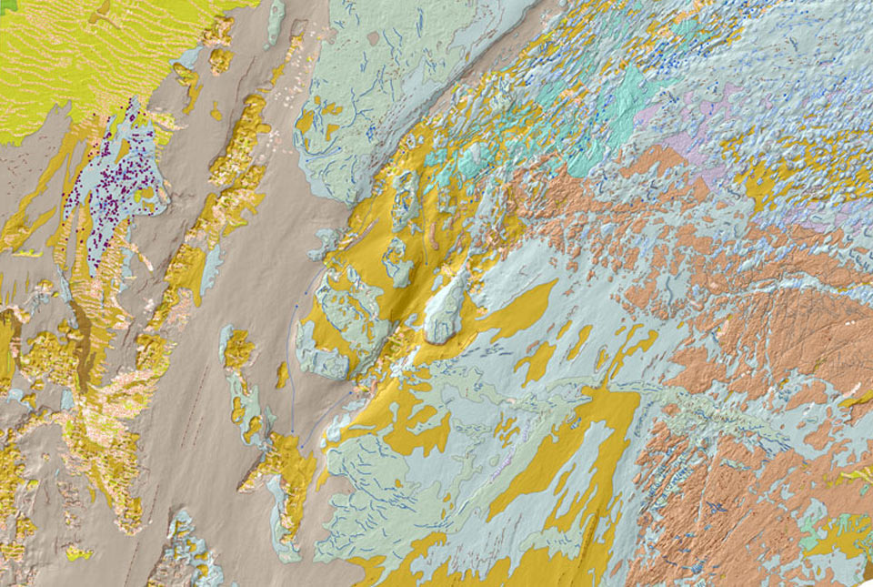
The seabed geology map dataset covers regions on the UK’s continental shelf and details the substrate geology, structural geology and seabed geomorphology.
- Open
- 1:10 000 – 1:50 000
- Regional

 Data Preview
The BGS Offshore Bedrock 250k dataset depicts the distribution of the different types of bedrock on the UK Continental Shelf.
- Open
- 1:250 000
- UK and adjacent European waters
Data Preview

The 1:250 000-scale offshore geological map for quaternary geology (BGS Geology: marine quaternary 250k) is available digitally.
- Open
- 1:250 000
- UK and adjacent European waters
 Data Preview
This offshore Quaternary geology dataset shows the distribution of interpreted lithostratigraphical units within the shallow subsurface. The dataset represents the Quaternary geology immediately beneath the active seabed sediment layer.
- Open
- 1:250 000
- UK and adjacent European waters
Data Preview
As a result of our annual price review BGS will apply, in most cases, a 3 percent increase* to our direct licence fees for our data products from 1st April 2026. This means that any direct licence issued or renewed on or after 1 April 2026 will reflect this increased price. Existing data licensees will not be affected until such time as their licence is next due for renewal, after 1 April 2026. BGS undertakes annual price reviews and will communicate any future licence fee changes (from 2027) as appropriate.
If you have any queries regarding this matter, please contact the IPR digital team (iprdigital@bgs.ac.uk).
* Due to the specific pricing of individual datasets please note not all price changes will equate exactly to 3%.