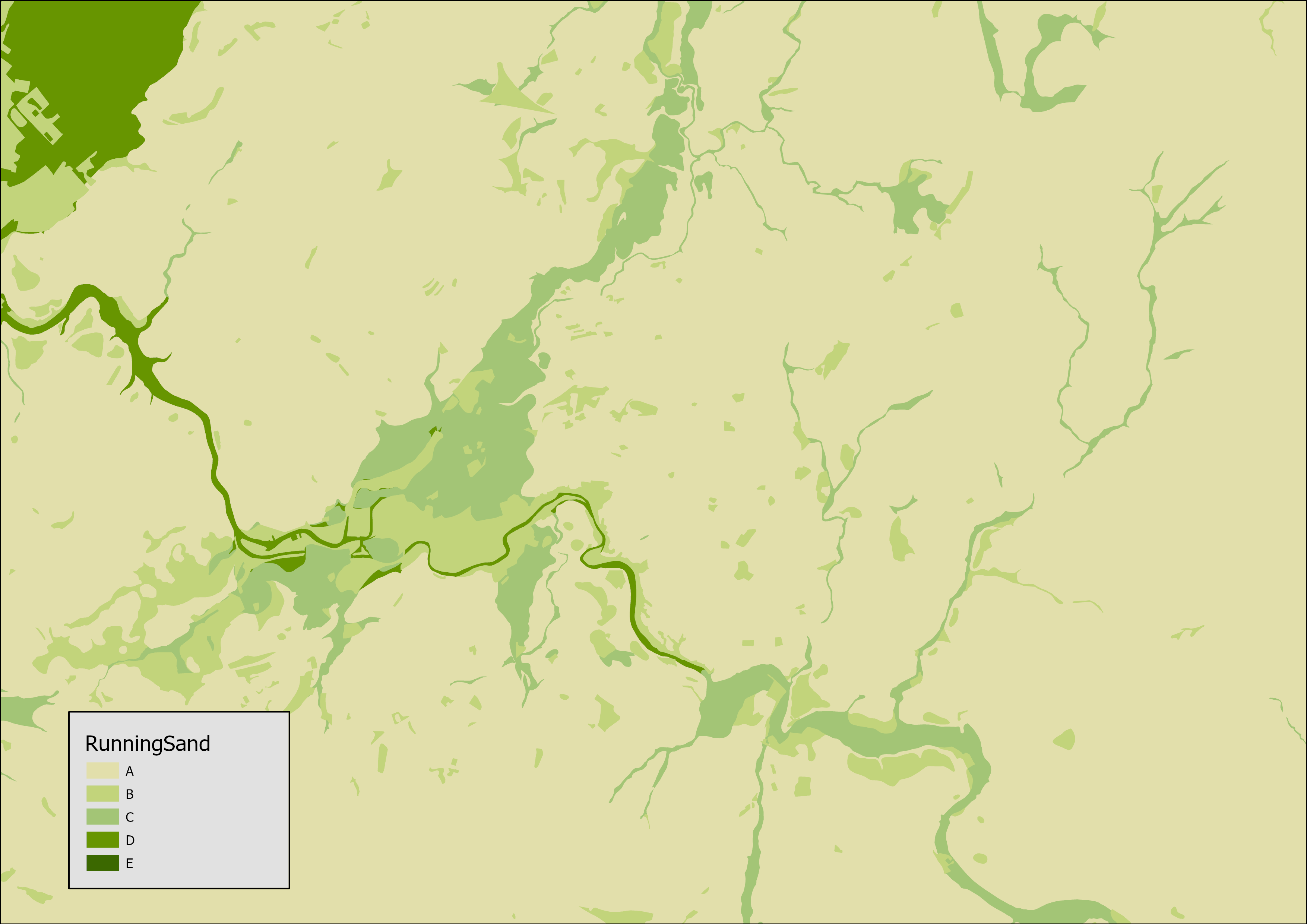

BGS GeoSure running sand. BGS © UKRI.
BGS GeoSure: running sand
- 1:50 000
- Great Britain
- Premium
The potential for running sand to be a hazard has been assessed using 1:50 000-scale digital maps of superficial and bedrock deposits. These have been combined with information from scientific and engineering reports. The detailed digital data illustrated in the map are available as attributed vector polygons, as raster grids and in spreadsheet format.
Supporting documents:
Key information
- Scale:
- 1:50 000
- Coverage:
- Great Britain
- Availability:
- Premium
- Price:
£0.23 per km2. Subject to number of users, licence fee and data preparation fee.
- Format:
- GIS polygon data (ESRI, MapInfo, others available by request)
- Uses:
- Local-level use
- Themes:
- Engineering geology, Hazards
- Sector:
- Construction and planning, Ground stability
Some rocks can contain loosely packed, sandy layers that can become fluidised by water flowing through them. Such sands can ‘run’, removing support from overlying buildings and causing potential damage.
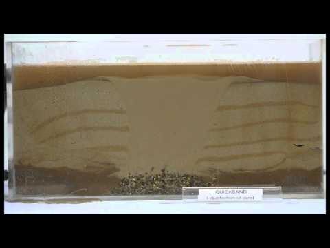

Watch the quicksand developing as the sand grains can no longer remain in their original horizontal layers. BGS © UKRI.
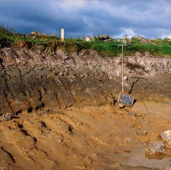
Running sand hazards can occur in various situations, for example:
- where excavations in sand go below the water table
- where springs occur at the base of sand outcrops
- around leaking drains or mains water supply pipes
- in entire sand bodies if vibrated (liquefaction) for example, by an earthquake
A property affected by running sand may experience the following problems:
- access paths and roads may be broken and disrupted
- service connections to water, gas and electricity supplies may break
- structural damage to foundations and to the fabric of the building if uneven sinking occurs under the foundations
The potential for running sand to be a hazard has been assessed using 1:50 000-scale digital maps of superficial and bedrock deposits. These have been combined with information from scientific and engineering reports. The detailed digital data illustrated in the map are available as attributed vector polygons, as raster grids and in spreadsheet format.
You may also be interested in


BGS GeoSure
The BGS GeoSure datasets identify areas of potential hazard and, therefore, potential natural ground movement, in Great Britain.
Running sand: property hazard information
Some rocks contain loosely-packed sandy layers that can become fluidised by water flowing through them. This can cause potential damage.