The BGS provides data online through a series of dedicated web services and feeds. This data can be visualised using a variety of software and viewers.
Web map services (WMS)
A standard method of providing map images that can be viewed in GIS software, virtual globes and portal-style websites using a map-based interface.

Web feature services (WFS)
A standard method of providing geographical features across the web. WFS provides real data as opposed to WMS that provides only images.

Application programming interfaces (APIs)
A standard software interface offering data access or data processing services between computers or computer programs.

OGC catalogue service for the web (CSW)
This OGC CSW service provides a standards-based interface to discover, browse, and query metadata about BGS datasets and data services.

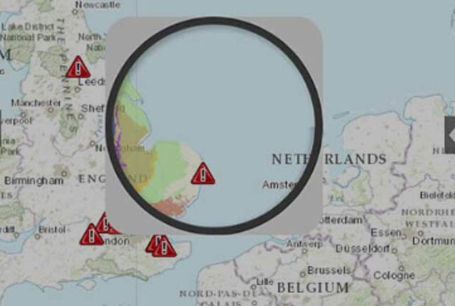
GeoRSS feeds — UK and worldwide earthquake map
GeoRSS feeds work as normal RSS feeds, but have additional location information embedded in each item. They can be incorporated into mashup-type applications using Google Maps and other available aggregators.
AGS download service
The BGS AGS download service provides free and open access to AGS geotechnical data held by the BGS.

Linked data
We publish some of our vocabularies and other structured data in accordance with linked data methodologies to enable them to be connected with other datasets and interpreted by machines.

Coordinate converter
Convert British National Grid to latitude and longitude (WGS84) via online form, web service or bulk conversion.
You may also be interested in

Technologies
Applications, software and online services created by the BGS and our collaborators.